6 FAQs about Villiers Island

POSTED: OCTOBER 13, 2023
In This Blog:
-
Together with the City of Toronto and CreateTO, we’re studying the best way to add more homes – including more affordable homes - to Villiers Island.
-
Public and stakeholder engagement has been ongoing as we study possible approaches to increasing housing on the island.
-
This has led to many good questions – such as what “density” means? We’ve compiled FAQs in this blog.
-
What’s next? The team has incorporated the feedback gathered from stakeholder interviews, the public meeting and the survey and will submit a report to the City of Toronto’s Planning and Housing Committee this fall. A public open house to share these updates is planned for early 2024.
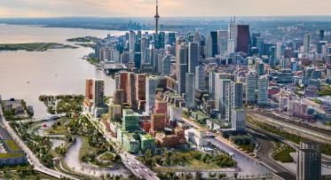
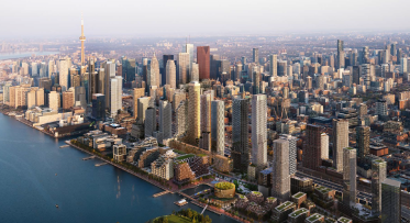
The Port Lands Flood Protection project opens 240 hectares of underused post-industrial land for development near downtown. Villiers Island is the first new community to be developed in the Port Lands and will be surrounded by great open spaces and parks. This creates an opportunity to build more housing, including affordable housing.
The City of Toronto, CreateTO and Waterfront Toronto are undertaking a study to determine the best way to increase the density on the island without compromising the vision contained in the Villiers Island Precinct Plan and Port Lands Planning Framework for a sustainable, complete community.
As we consider options for increasing density on Villiers Island, we’re engaging stakeholders and the public to make sure we’re upholding the shared vision for Villiers Island developed through consultation and updating plans to reflect their experiences and priorities.
At a public meeting in June 2023, we presented some possible approaches for increasing density on the island. This was followed by a public survey to understand people’s priorities as we continue to weigh the pros and cons of various approaches. Here is a summary of that feedback: Villiers Island Density Study Public Meeting Summary (portlandsto.ca).
We gathered public input at that June meeting – also answered lots of questions. More feedback and questions came through a corresponding survey. Here are the top six FAQs.
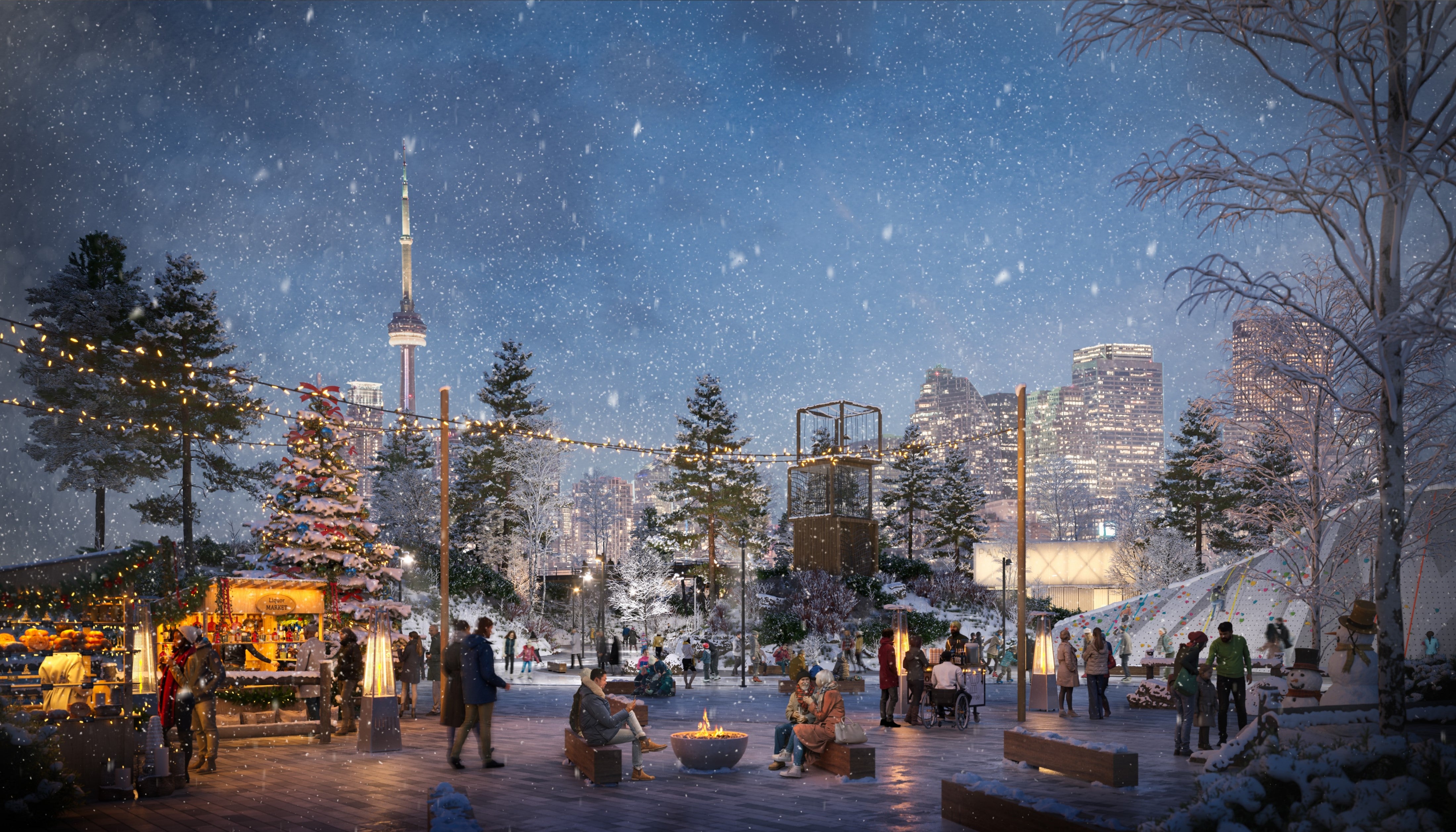
This rendering of a winter market in Promontory Park shows one potential use for new public space on Villiers Island as the community develops.
1. What does adding density mean?
The density of a neighbourhood can refer to the number of people, buildings (often measured in what is called “gross floor area or GFA”), or housing units in a given space. In simpler terms, it’s the number of residents and employees per square kilometre.
Density sometimes means putting buildings closer together, but in a case like Villiers Island, where there are already buildings planned in the available space for them, adding density means building taller to accommodate more people.
Toronto City Council gave our project team a clear goal: to maximize the amount of housing on Villiers Island, thereby increasing the number of affordable homes. Achieving this goal means increasing the density of the Island. The goal is to increase density by at least 30% over the original precinct plan. Ongoing studies indicate the potential to surpass this target.
In June 2023, we gathered input on potential approaches to increase density, primarily by expanding the Gross Floor Area (GFA) by adding taller buildings. This input suggested that we could potentially increase GFA by 40% to 60% over the 2017 precinct plan. We are now using this input to develop a draft plan for Villiers Island, which we will share with the City and the public for further feedback during the fall and winter months.
2. What about a school, grocery store, or other retail space?
Part of the work being done now is ensuring that development is supported by the community facilities a new neighbourhood needs. For example, the 2017 precinct plan provides a site (and an option for a different site) for a new school on the island. The plan also allocates space for a community centre and recreational facility.
In addition to community services and facilities, we’re making sure that the future development will include retail, service and what we call commercial animation uses. While big changes in the retail landscape have reduced the demand for bricks and mortar retail, the increase in residents on Villiers Island will help attract retailers. More local customers will hopefully sustain new businesses year-round.
3. How will the buildings be designed?
Developers for the buildings haven’t been selected yet. They will be selected through a competitive process where proponents will bring forth their vision for sites within the island.
Any new development will be required to come to Waterfront Toronto’s Design Review Panel.
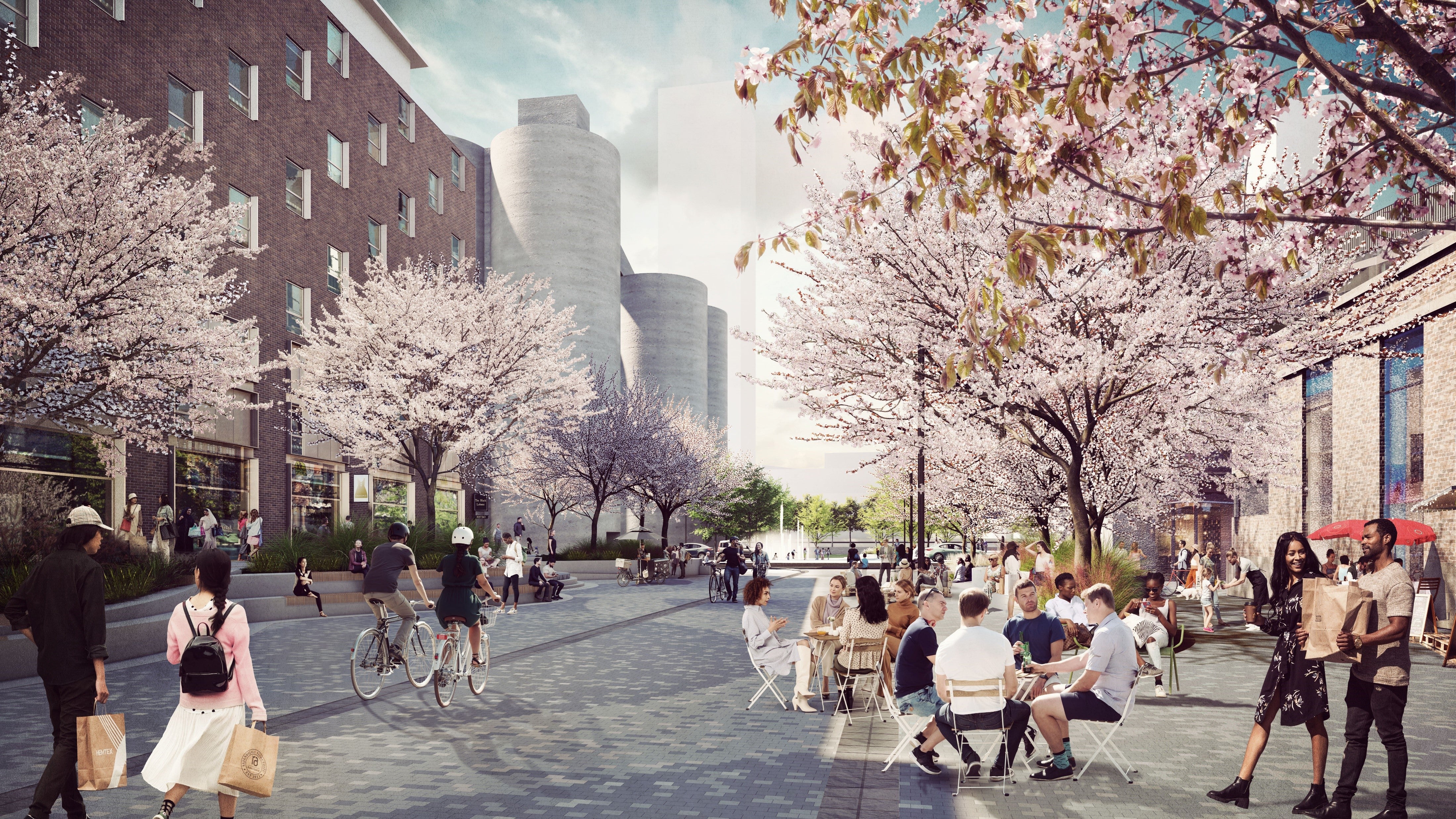
Buildings on Villiers Island haven’t been designed yet. Renderings like this one only show buildings to give a sense of their footprint and massing. But they do show the vision for vibrant public spaces, like this pedestrian-focused street.
4. How much affordable housing could be built?
The City, CreateTO, and Waterfront Toronto are establishing the level of housing achievable after taking into consideration the existing policy framework, public policy priorities, transportation network, and proposed community and servicing infrastructure. The affordable housing strategy for Villiers Island will include a minimum of 20 per cent and a target of 30 per cent affordable rental homes on public lands.
5. Why do we need to build towers to create more housing units?
A few people at the public meeting questioned why we need to build towers to add more homes. This is because the general locations and footprints of buildings on Villiers Island have already been established. Villiers Island has a limited amount of land available for development. Anywhere that doesn’t have a building planned for it already has another designated use – like a community facility, public plaza or park. Because we know parks and public spaces are vital to complete communities, we don’t want to replace these spaces with residential buildings. That means the only option for adding homes is to build up. By incorporating a variety of building heights, and ensuring adequate spacing between towers we can create a place that's not only comfortable for residents but also welcoming for those who visit and explore.
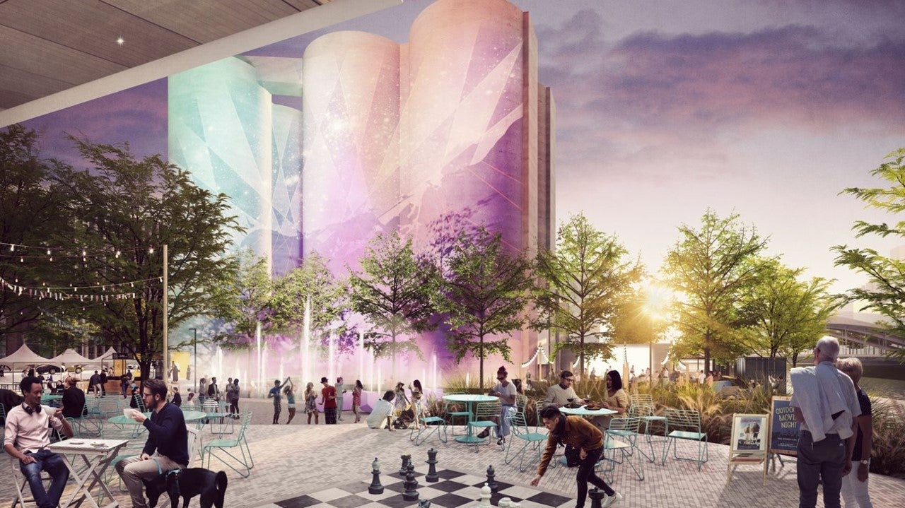
A public square at the base of the Silos in the northwest corner of the island is part of the precinct plan and will not be impacted by increasing the density of the island, except to have a few more regular visitors.
6. Will you add buildings into the planned park space?
Some commenters were concerned that we would add buildings in the new parks that we’re building. The additional housing units we’re adding will be achieved by making the planned buildings taller – not by adding whole new buildings. The 25 hectares of publicly accessible greenspace we’re building in the Port Lands would not be changed or reduced in any way. We are currently spending a lot of time and money building them! Similarly, the planned public spaces, such as public plaza at the base of the silos and pedestrian-centred streets, would not be impacted, because the general footprint of future buildings isn’t changing from what was imagined in the precinct plan.
In addition to 25 hectares of greenspace, Port Lands Flood Protection is also creating new wetlands, marshes and other aquatic habitats. Where are all these parks and natural greenspaces? Check out this map that shows what we’re building.
What’s Next?
A report synthesizing feedback gathered from stakeholder interviews, the public meeting and survey results will be submitted to the City of Toronto’s Planning and Housing Committee in 2024.
The report will include an update on work the team has done to refine the proposed approach to increasing density to support the maximum amount of housing achievable on Villiers Island.
A public open house to share these updates is being planned for early 2024.
The team is also undertaking various technical studies including a Community Services Review and is planning to bring official plan amendments and zoning by-law amendments to City Council later next year.
Whether it’s an addendum or updated plan will depend on the scope of the changes proposed. That will then be supported by a business and implementation plan for the first phase of expected development on Villiers Island.
Where can I learn more?
Materials from the public meeting, as well as a summary of the meeting are available on our website.
- See the presentation
- Watch the public meeting presentation
- Read a summary of the public meeting, including answers to all the questions we received and a summary of the survey
Want to be involved in future public consultations? Sign up for our newsletter to receive regular updates.