Bringing the Toronto’s Historic Shoreline to Life: the Liquid Landscape at Fort York


Beneath the Gardiner Expressway the landscape around the Fort York Visitor Centre will use natural plantings of tall grasses to mimic the historic shoreline of Lake Ontario, including ice skating during the frozen months. (Image credit: PUBLIC WORK.)
By Jake Tobin Garrett
POSTED: May 30, 2016
This is the second in a series of four blog posts that explore different places that are part of Project: Under Gardiner.
One of the exciting things about Project: Under Gardiner is the multiple layers of history that are embedded in the site – sometimes literally, in the form of archeological artefacts related to the Fort York National Historic Site. These histories – whether indigenous histories, the historic shoreline, the grand trunk railroad, Fort York, or the building of the Gardiner itself – are opportunities to pull out different themes, both in design and in programming.
It’s the area dubbed the Liquid Landscape where many of these converge. This is the area east of Strachan and the proposed Strachan Gate performance space and west of Fort York Boulevard. This area, which acts as basically the front door to the Fort York Visitor Centre, is also the point where the Gardiner is at its highest – so high, in fact, that you could nearly fit a five-storey building underneath it.

This map shows the location of the Visitor Centre and the proposed landscaped areas, including the Liquid Landscape and Shoreline Gardens. (Image credit: PUBLIC WORK.)
If you think the underneath the Gardiner is dark and gloomy then you’ve obviously never stood underneath this section, which receives a ton of light, especially in the afternoons. Indeed, this is the spot where soft landscaping – a mixture of native grasses and meadow plants – is proposed. These native grasses are meant to wave softly in the breeze, evoking the image of swelling water that is a throwback to the historic Lake Ontario shoreline, which ran roughly along this spot.
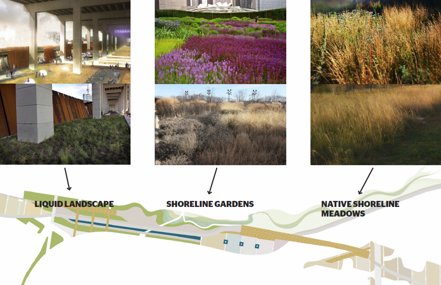
Artists’ sketches and photographs show examples of the types of native plantings that would make up the Liquid Landscape, Shoreline Gardens and Native Shoreline Meadows.
Also included here are the proposed “docks” that will jut out from the Visitor Centre and create spaces for gathering and performance. I remember coming to the opening of the Visitor Centre and listening to a choir perform underneath the Gardiner. I was surprised at how amazing the acoustics were under there.
On the walking tours we’ve been leading, people have had some really great ideas for how you could program this particular space. One man suggested that it could be used as a kind of outdoor Toronto museum, while another suggested decorating each of the supporting “bents” or columns for all the different cultures that make up Toronto.
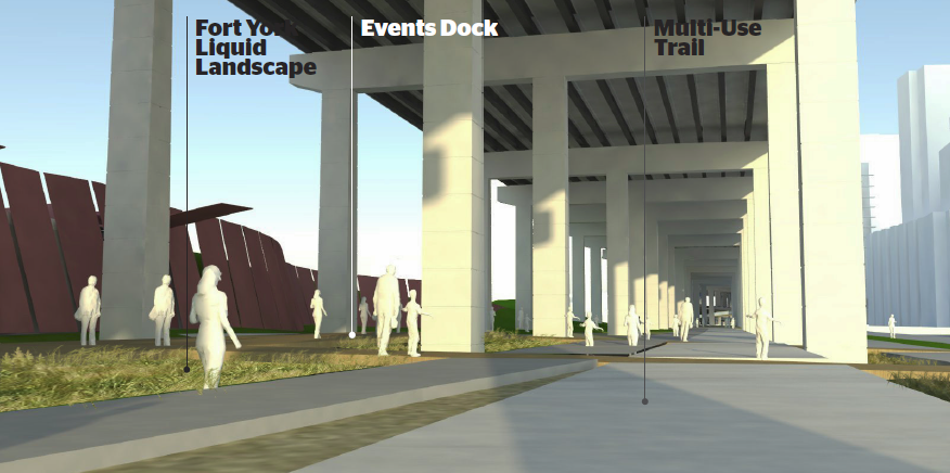
Viewed from in front of the Fort York Visitor Centre, looking east, this rendering shows the proposed configuration of the Liquid Landscape, Events Dock and the Multi-Use Trail. (Image credit: PUBLIC WORK.)
Several people echoed a suggestion one woman had to set up a market or food trucks to take advantage of the nearby Fort York Boulevard and the condo buildings that front it. One student made a great point about ensuring the space is lively in the winter. He suggested ice sculptures to draw people to the space during the colder months.
This area also contains the proposed skating rink and trail that will be the longest in Toronto at 450 metres long. The skating trail would offer a great experience to meander your way along part of the Under Gardiner on your skates, but it could also be designed to accommodate things like outdoor curling. Hard to get more Canadian than that.
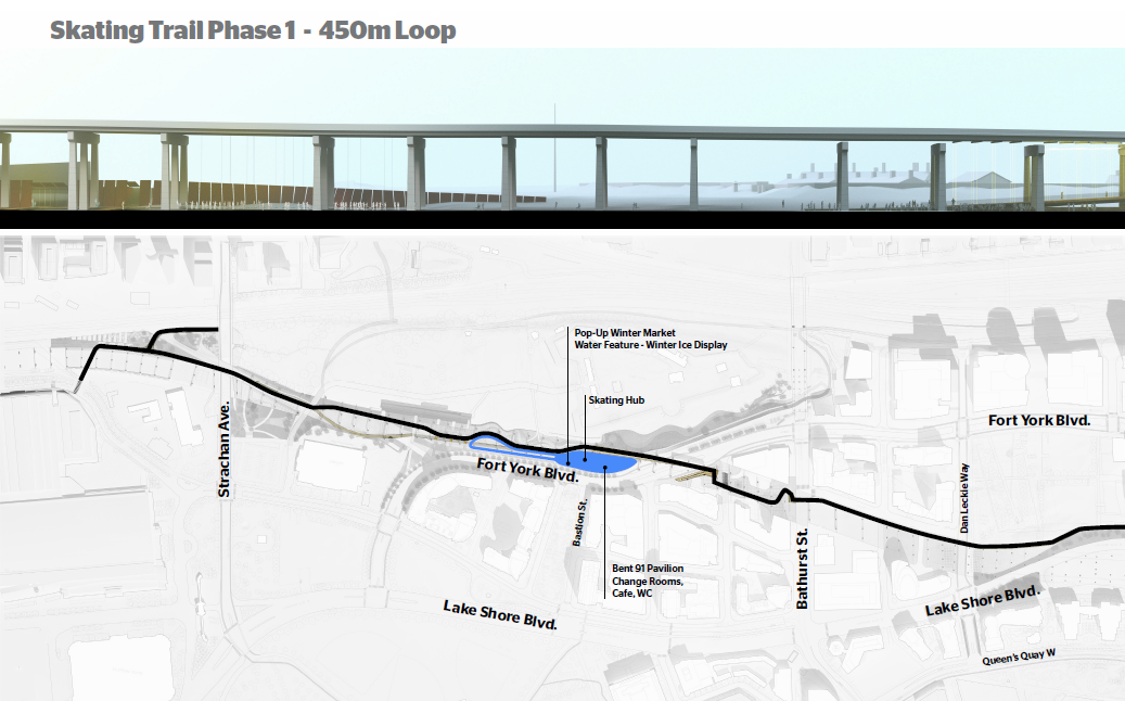
This sketch and overhead map shows the winter location of the skating rink and 450-metre skating loop proposed as part of the first phase of Project: Under Gardiner.
No lack of ideas here. People were clearly excited about what this space could offer and what could be done given its height and openness. What do you see happening here?
Loading...
Want to learn more about Project: Under Gardiner? Head over to www.undergardiner.com to learn more.