What’s Next for Parliament Slip?
Re-imagining this post-industrial port
POSTED: DECEMBER 16, 2021 I DESIGN, INFRASTRUCTURE, PARKS AND PUBLIC SPACES
By: Carol Webb
At the peak of marine shipping around the turn of the 20th century, Toronto’s waterfront was bustling with commercial activity. Toronto’s growing demand for port facilities led to extensive lake filling and industrialization of the shoreline. The new inner harbour shoreline — from the Portland Slip in the west to the Port Lands in the east — was studded with marine terminal buildings and a series of ‘slips’, where ships would dock to unload their cargo.
As the movement of goods changed and the city of Toronto evolved, many of these functions were no longer needed and the area became derelict and disconnected from the city. Reconnecting the city to the waterfront has been a focus for Waterfront Toronto since it was created. Over the past two decades, considerable progress has been made transforming these lands into a vibrant and connected waterfront designed to draw people back to the water’s edge and experience one of Toronto’s greatest assets: the lake.
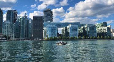
The post-industrial waterfront was lined with disused marine terminals, parking lots and a series of slips that once served the shipping industry. Shown above is East Bayfront, framed by Jarvis Slip on the left and Parliament Slip on the right circa 2005.
In 2006, we hosted a design competition that led to the transformation of Queens Quay West, the Water’s Edge Promenade and the series of WaveDecks at the head of the Spadina, Simcoe and Rees slips. Parliament Slip will be our next focus.
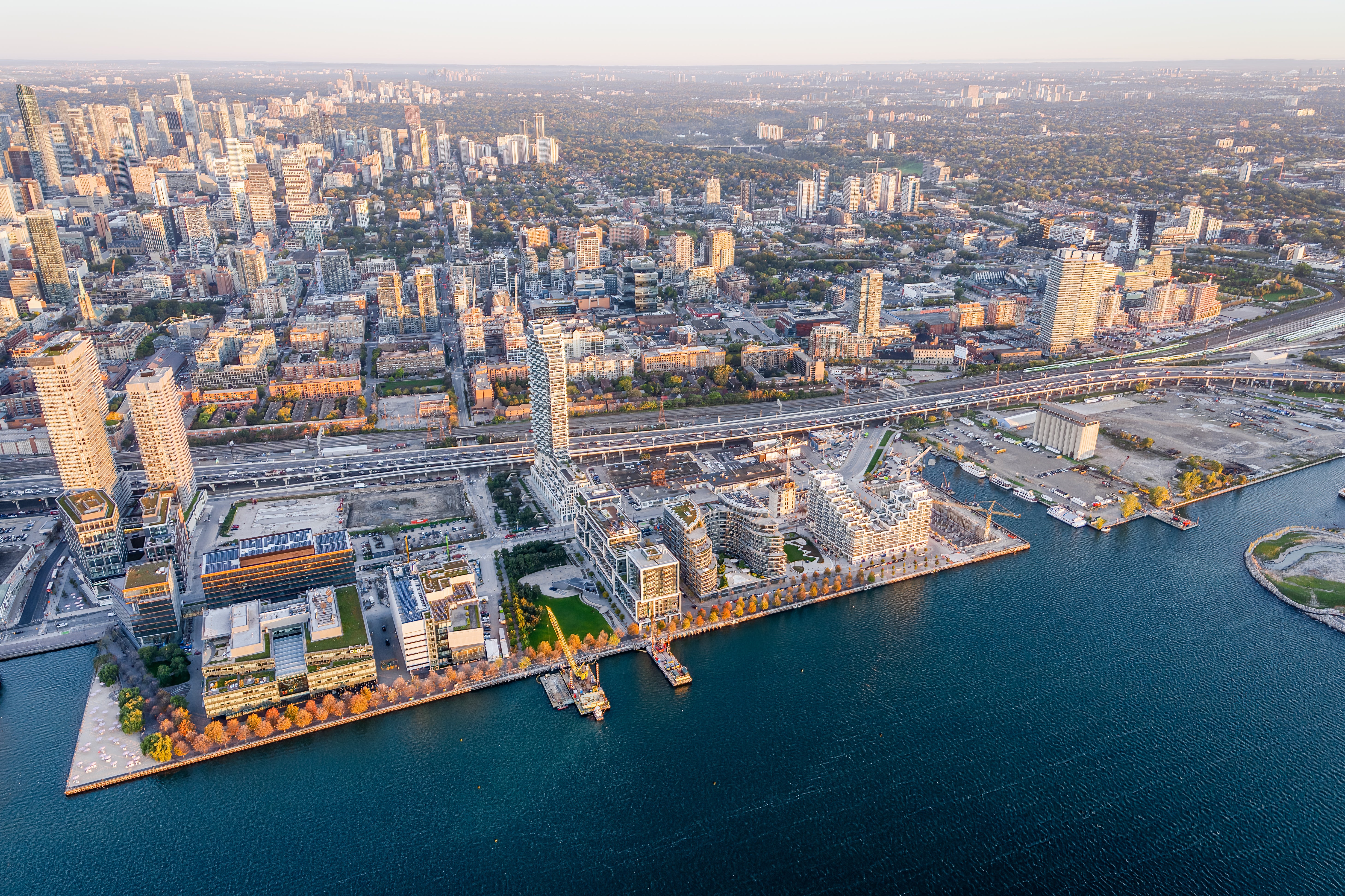
Today’s waterfront includes new parks and public spaces. Seen here is East Bayfront including Canada’s Sugar Beach, Sherbourne Common, Aitken Place Park and the Water’s Edge Promenade. Parliament Slip is on the right side of the image and just visible is the edge of Villiers Island.
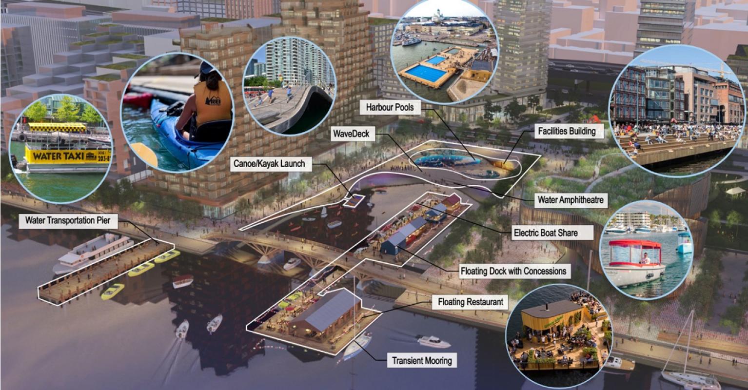
Here, at the foot of Parliament Street and a stone's throw to the future Villiers Island and Promontory Park, we can innovate on the beloved WaveDeck concept from the west and create a world-class public destination for swimming, kayaking, boating, entertainment, and dining.
Inspired by the undulating shorelines of the Great Lakes, the WaveDecks are whimsical and dynamic by design. They are built out over the water creating generous new public spaces above and vital fish habitat below.
The proposed design for Parliament Slip will help connect nearby communities as well as people from across city with the lake and Villiers Island, creating a place where both residents and visitors alike can enjoy a visit to the water’s edge. People will be drawn to the slip to spend the day swimming in an open-air pool, launching a kayak, enjoying a picnic or snack from one of the concessions on the floating dock, or simply watching the theatre of activity in the water.
Although funding is not yet in place, we continue to advance the design. Lots more input is still needed from the public, too! Stay tuned for more information about consultation in 2022.
Visit the Parliament Slip project page to learn more and check out the renderings below.
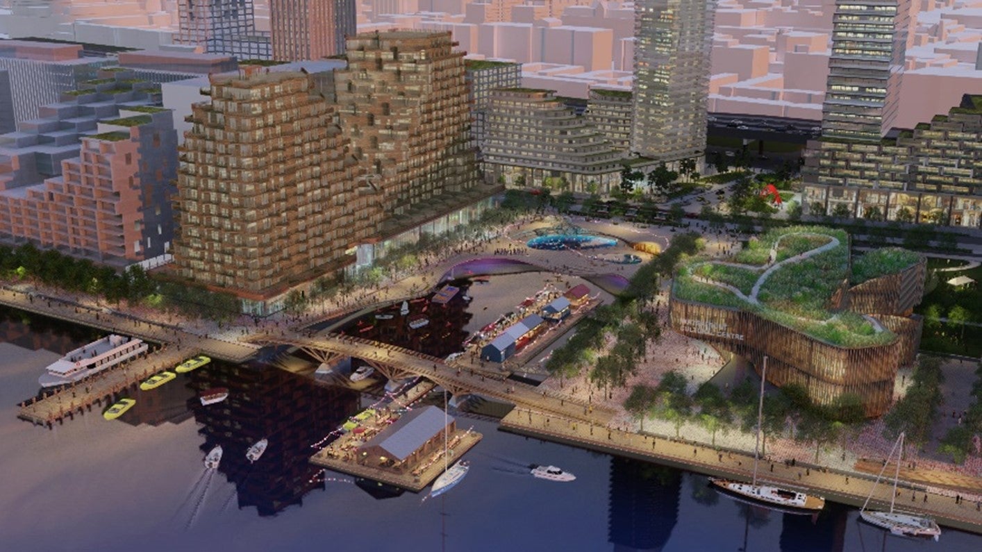
A Place that Connects: Parliament Slip has potential to become a vibrant public destination and a strong point of connection between the city and Lake Ontario. Rendering: courtesy of West 8 + DTAH
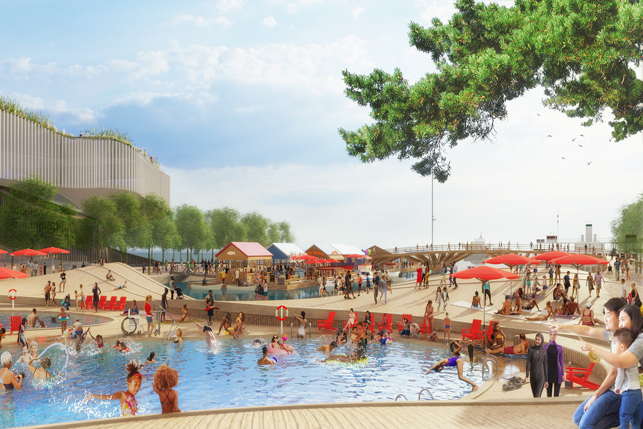
View over the swimming pool looking southeast. Rendering: courtesy of West 8 + DTAH
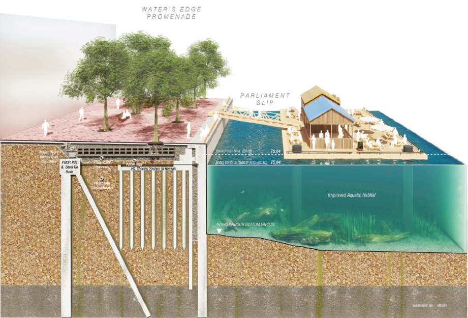
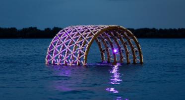
While a great public amenity will emerge above the water, great aquatic amenities will be added below, including important fish habitat to ensure a healthy underwater ecosystem. Rendering: courtesy of West 8 + DTAH

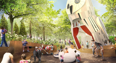
Parliament Slip will be nestled between a community centre to the west, a park to the east and Water’s Edge Promenade to the south. Rendering: courtesy of West 8 + DTAH
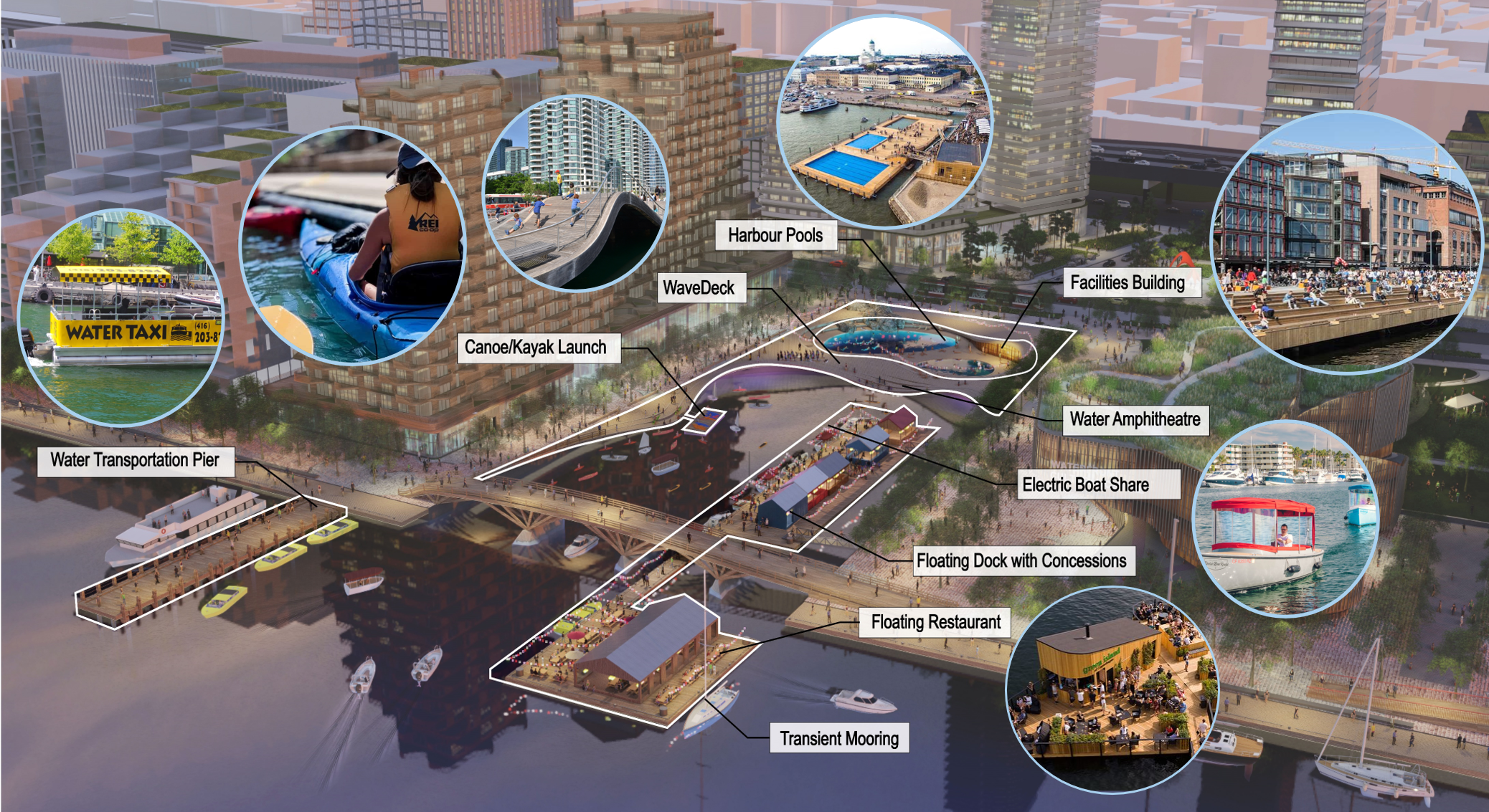
Features of Parliament Slip include Harbour Pools nestled within the WaveDeck, an amphitheater for sitting at the water’s edge, floating dock with concessions and so much more. Rendering: courtesy of West 8 + DTAH

