Connecting People to the Waterfront

A vision for enhancements to the Gardiner underpass at Rees Street and Lake Shore Boulevard. (Image provided by PUBLIC WORK)
POSTED: OCTOBER 10, 2019 I COMPLETE STREETS, DESIGN, INFRASTRUCTURE, INNOVATION, PARKS AND PUBLIC SPACES, TRANSPORTATION
By Mira Shenker
Part of our mission is to connect people with the water. Sometimes those connections are physical and sometimes they’re psychological.
We’ve been working on eliminating physical barriers to Lake Ontario by protecting and creating public space along the water’s edge. We recently opened Phase 2 of the Water's Edge Promenade at Bayside, so it is now walkable from Jarvis Street to the eastern edge of Aitken Place Park. Once Phases 3 and 4 are completed, there will be an uninterrupted connection along the water's edge from Jarvis Street to Parliament Street. Parks in that neighbourhood at Lower Sherbourne Street and Merchants Wharf connect people south from Queens Quay down to the water’s edge.
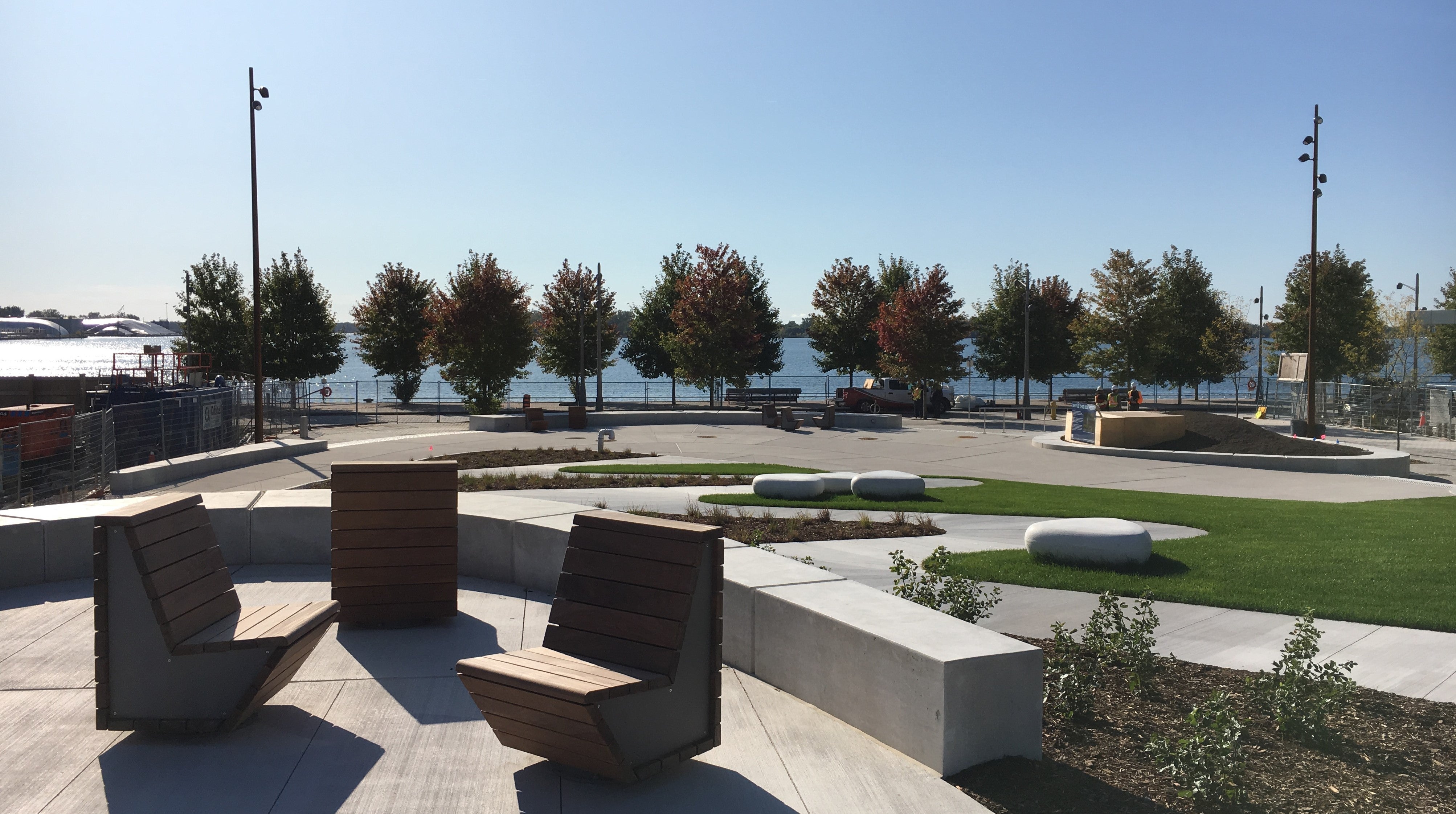
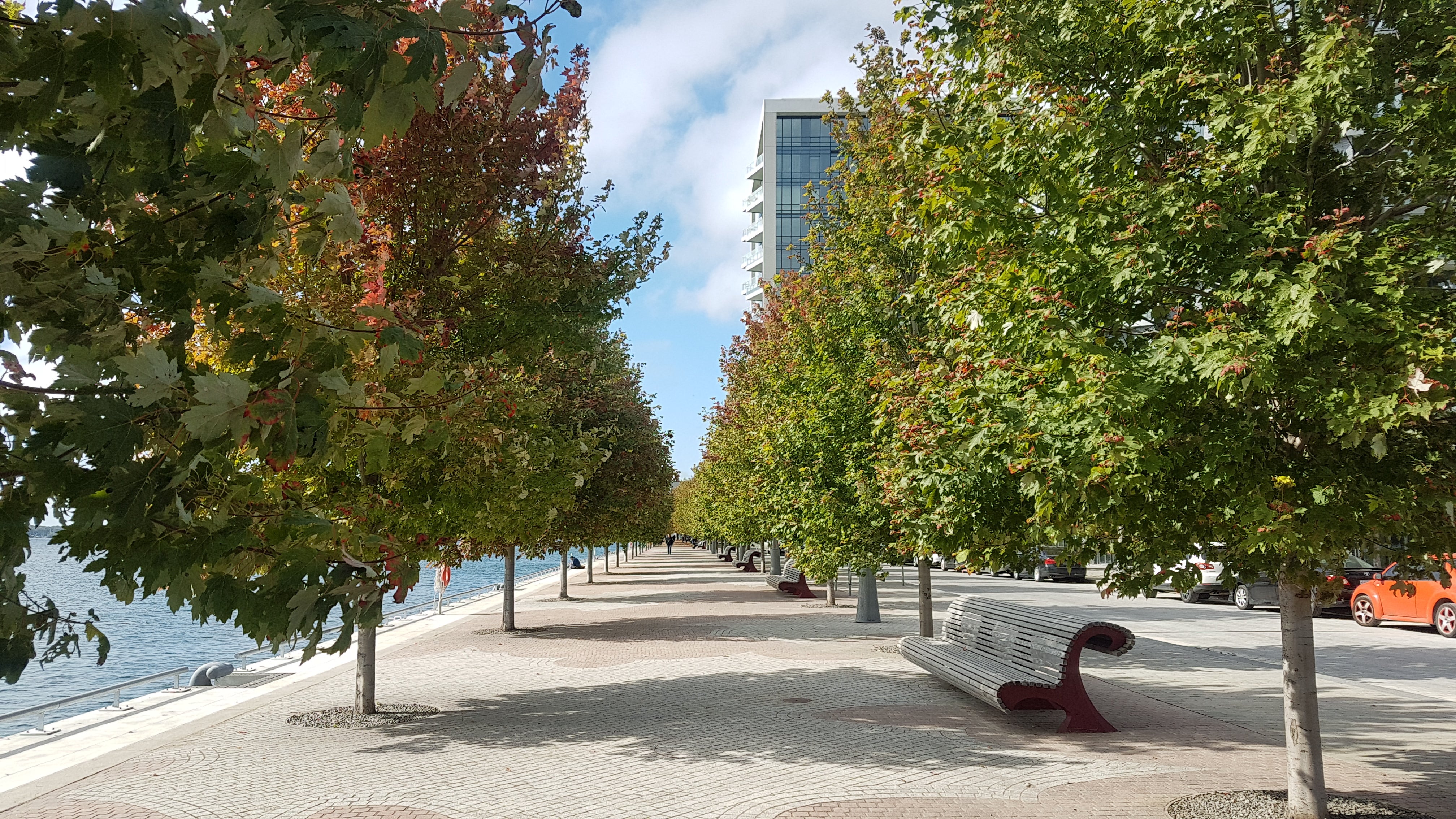
(Top) A view south through the new Aitken Place Park towards the newly completed Water's Edge Promenade at Bayside. (Bottom) The newly opened Water's Edge Promenade at Bayside including a healthy new tree canopy.
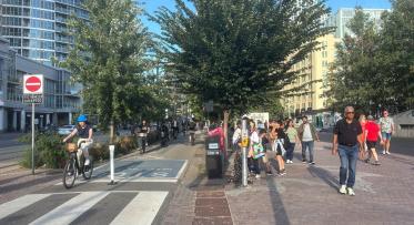
But the connection from Lake Shore Boulevard is a little trickier. It faces a psychological barrier: the elevated Gardiner Expressway. That structure makes for a daunting crossing for pedestrians and cyclists heading south to the lake.
These underpasses create a natural stopping point for anyone venturing south. It’s hard to know that there’s anything worth seeing on the other side of the loud, dark tunnels at intersections like Rees Street and Lake Shore Boulevard. And if you do have to cross Lake Shore, the experience is unpleasant, to say the least.
These blank spaces can be turned into treasured community landmarks with a little vision – and support from governments, local business and community members. We’ve seen it work at Underpass Park, where an art installation, mural art, a playground and skate park brought light and life to an unused space. Situated beneath the Eastern Avenue, Richmond and Adelaide Street overpasses, the park gives people a safe, inviting route from Corktown to the new West Don Lands neighbourhood.
 An art installation, mural, playground and skate park transformed Underpass Park. (Image by Nicola Betts)
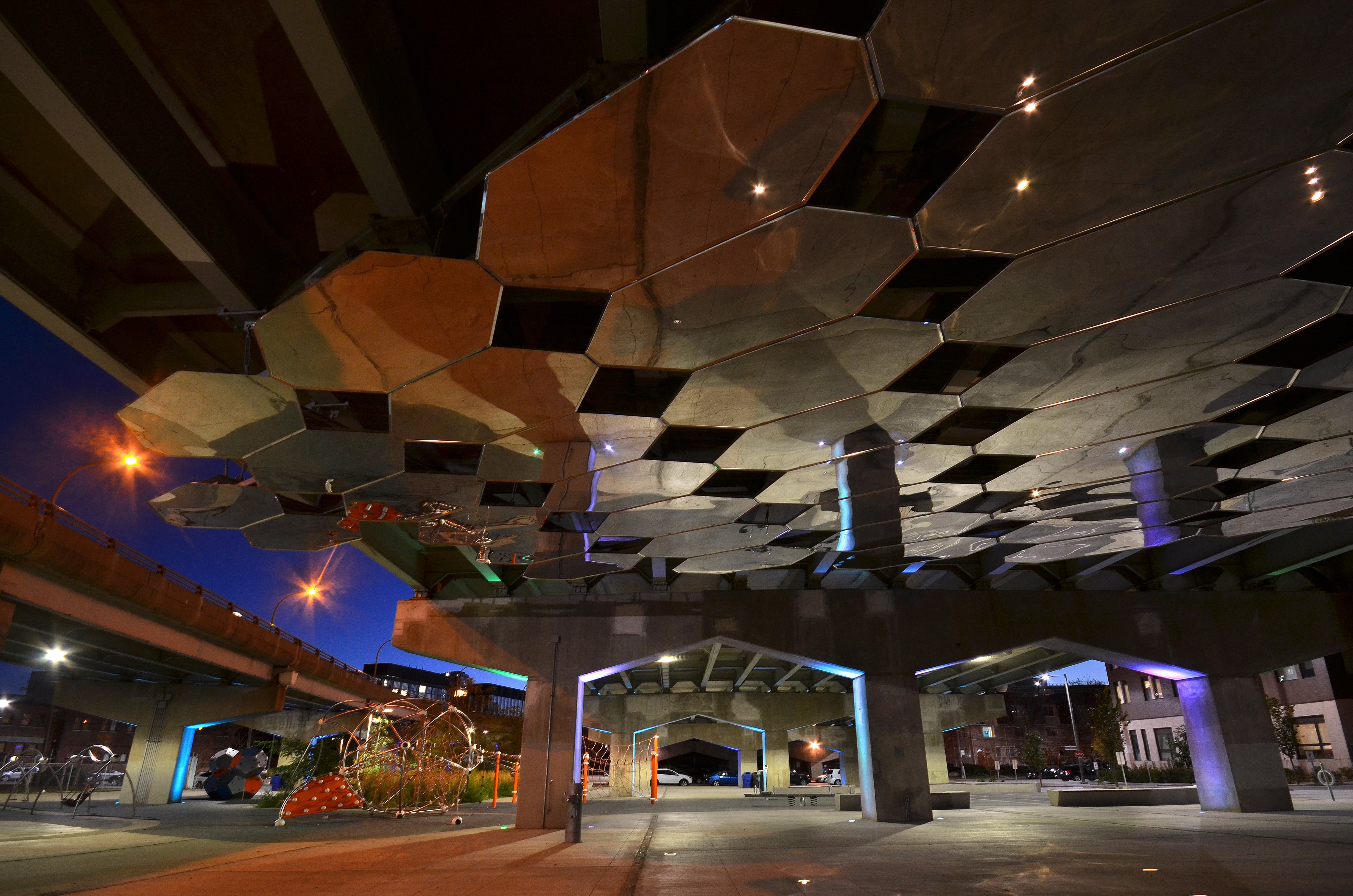
And at The Bentway, new programmable spaces have changed people’s attitude about the potential to reclaim public space under this city’s elevated expressway.
To help make more underpasses safe and more accessible for vulnerable users, the Waterfront Business Improvement Area (BIA) spearheaded a new project called Waterfront ReConnect. Co-funded by the City of Toronto, this project aims to transform intersections across Lake Shore under the Gardiner. We’re working with the same team that designed The Bentway to continue breaking down this barrier and connect people to the waterfront. The plan developed by Ken Greenberg and PUBLIC WORK for the first of these transformations at Rees Street includes:
- Gold paint on the bents to reflect light under the Gardiner
- Enhanced markings in the pedestrian crossings
- Text on bents inviting people to the neighbourhood
We’re also working with the City of Toronto on public realm enhancements along Lake Shore Boulevard further east, which will be implemented along with the Gardiner East realignment. Slated to start in a few years, this could include intersection improvements, additional planting and trails to enhance pedestrian and cycling connectivity across the perceived barrier of the elevated highway.
This will be part of the major transformation happening in the eastern waterfront, including a realigned Cherry Street as part of our Port Lands Flood Protection project. Over time, we hope that the intersection of Cherry Street and Lake Shore – currently one of the toughest connections for cyclists and pedestrians – should become a place where people can easily connect to the new parks and river valley we’re building in the Port Lands.
Share your thoughts, comments and feedback.
Follow us on Facebook and Twitter – and join the conversation about waterfront revitalization using the #TOtheWaterfront hashtag.

Flood Protection Milestone Puts New Waterfront City Within Reach
Sustainable Skyline: How Mass Timber is Shaping Toronto’s waterfront