Why We’ll Soon Say Goodbye to the Old Eastern Avenue Bridge

PUBLISHED: AUGUST 21, 2024
In This Blog:
- The old Eastern Avenue Bridge contributes to the risk of flooding in that area. The low-lying bridge would be an impediment to flood waters during a major storm. Past the end of its service life, the bridge is not structurally sound, making it highly vulnerable to failure during future flooding events. If that were to happen, it could cause damage when it breaks and flows downstream.
- Although it has been closed to the public since 1965, we know people have a connection to this bridge.
- The bridge is listed by the City of Toronto but did not meet the criteria for heritage designation under the Ontario Heritage Act.
- The project team is working with City of Toronto Heritage Planning on a commemoration plan.
Flood protecting the eastern waterfront has been a multi-stage process. The first phase was the flood protection landform that we built as part of Corktown Common, followed by the Port Lands Flood Protection (PLFP) project, due to be complete next summer.
The Broadview and Eastern Flood Protection (BEFP) project will protect a small area still at risk of flooding after PLFP’s completion. It allows for the future Broadview Avenue extension and is the final piece to enable the rezoning of the East Harbour Precinct for mixed-use development.
The first phase of construction for this project is the removal of the old Eastern Avenue bridge across the Don River, scheduled to start in fall 2024. The Old Eastern Avenue bridge is the metal truss bridge that crosses the Don River, near the north end of Corktown Common.
Although it has been closed to the public since 1965 when the Don Valley Parkway was opened, the bridge is a familiar landmark along the Lower Don Trail . Despite the visual interest it creates, the bridge is contributing to the flood risk. In a flood, the bridge would impede the flow of water down the Don River, causing it to build up and flood more deeply, or it would collapse, which could make the flooding significantly worse and potentially damage downstream infrastructure and the new river valley created by Port Lands Flood Protection.
The history of the old Eastern Avenue Bridge
The area that is now the Canary District and Corktown Common has been through a lot of changes in the past 150 years. Before it became an industrial area, it was the end of a deep ravine containing a meandering Don River. As the river got closer to the lake, it transitioned into a coastal marsh in what was called Ashbridge’s Bay. The soil was made up of fluvial soils - soil deposited by the river – which was highly erodible and vulnerable to flooding. In the 1800s, the river was straightened and the land was built over for industrial and railway uses . Although the area had been built up, the risk of flooding remained. Factories and warehouses prospered there in the early 1900s, but by the 1980s, the area was in decline and faced significant challenges to redevelopment: soil contamination and the continued risk of flooding from the Don River.
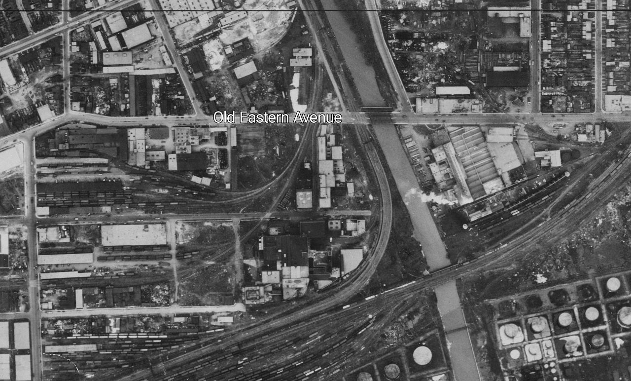
This aerial photo from 1947 shows Eastern Avenue in its original alignment (prior to the construction of the Don Valley Parkway) using the bridge to cross the Don River. The area is full of large warehouses, factories, and railcars. Image courtesy of the City of Toronto Archives.
Eastern Avenue was a main east-west connection over the Don River, and a bridge over the Don River has been in that location for a long time. In fact, the bridge you see today is the fifth bridge to cross the river there. Several previous bridges were destroyed by flooding or general deterioration. The existing bridge was built in 1932 and was in operation for approximately 33 years.
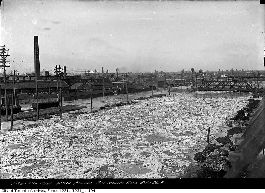
This photo from 1918 shows the Don River flooding just north of a previous iteration of the Eastern Avenue Bridge. Floods in this area resulted in the need to build new bridges in this location several times over the years. Image courtesy of the City of Toronto Archives.
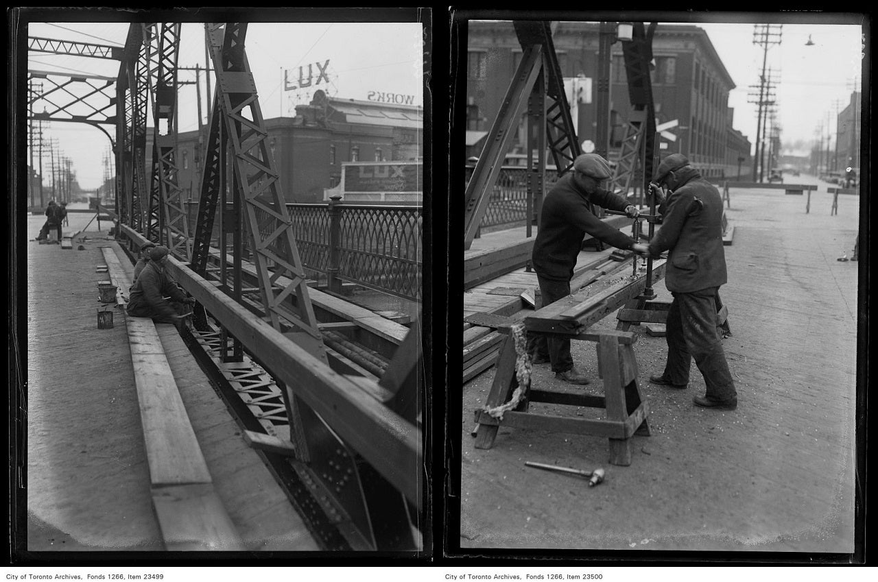
These photos from 1931 show construction on the bridge. In the background, you can see how close this bridge was to nearby factories and warehouses, which eventually left the area. City of Toronto Archives, Globe and Mail fonds, Fonds 1266, Item 23500 & 23499.
In the 1960s, the area began to undergo even more substantial changes with the construction of the Don Valley Parkway (DVP). Eastern Avenue was realigned further north, and the old bridge became a bridge to nowhere. The bridge has been closed to the public since the DVP was completed and Eastern Ave was realigned in 1965.
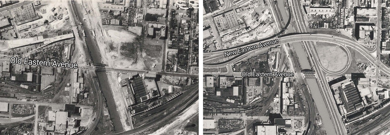
Left: this aerial photo from 1964 shows the last year the bridge was in use. Right: in 1965, Eastern Avenue was realigned further north along with the Construction of the Don Valley Parkway. You can see how the old Eastern Avenue is cut off by the new DVP.
The City of Toronto decided that leaving the bridge in place and maintaining it was a more cost-effective solution than removing it. So, the bridge remained in place after it was closed, even though it did not connect anywhere, and the bridge has been fenced off from public access for decades, largely without maintenance.
A structural assessment in 2022 determined it was in poor condition and at risk of failing.
What’s next?
While leaving the bridge in place was determined to be the best solution in the 1960s, our understanding and modelling of urban flooding has improved a lot since then.
The bridge is listed by the City of Toronto but did not meet the criteria for heritage designation under the Ontario Heritage Act.
Because the bridge is so close to the DVP and the rail corridor, removal is being planned carefully to avoid requiring any closure of the DVP or interruptions to rail operations. Most of the removal will take place from a barge in the river. These logistical constraints, along with the poor condition of the bridge’s materials, present some challenges in salvaging or repurposing the bridge.
The project team is working with City of Toronto Heritage Planning on a commemoration plan.
Interested in more history of this area of Toronto? Learn more about the history of the Port Lands, located just south of here.