Queens Quay (West)
Our city's main waterfront street has been transformed into a showpiece for the city.
Queens Quay, which runs east-west parallel to the lakefront, is the waterfront’s main street. It spans more than 3 kilometres from Bathurst Street in the central waterfront to Parliament Street in East Bayfront, the new waterfront neighbourhood currently being developed by Waterfront Toronto. In the central waterfront, we have transformed Queens Quay into one of the world’s most beautiful waterfront boulevards.
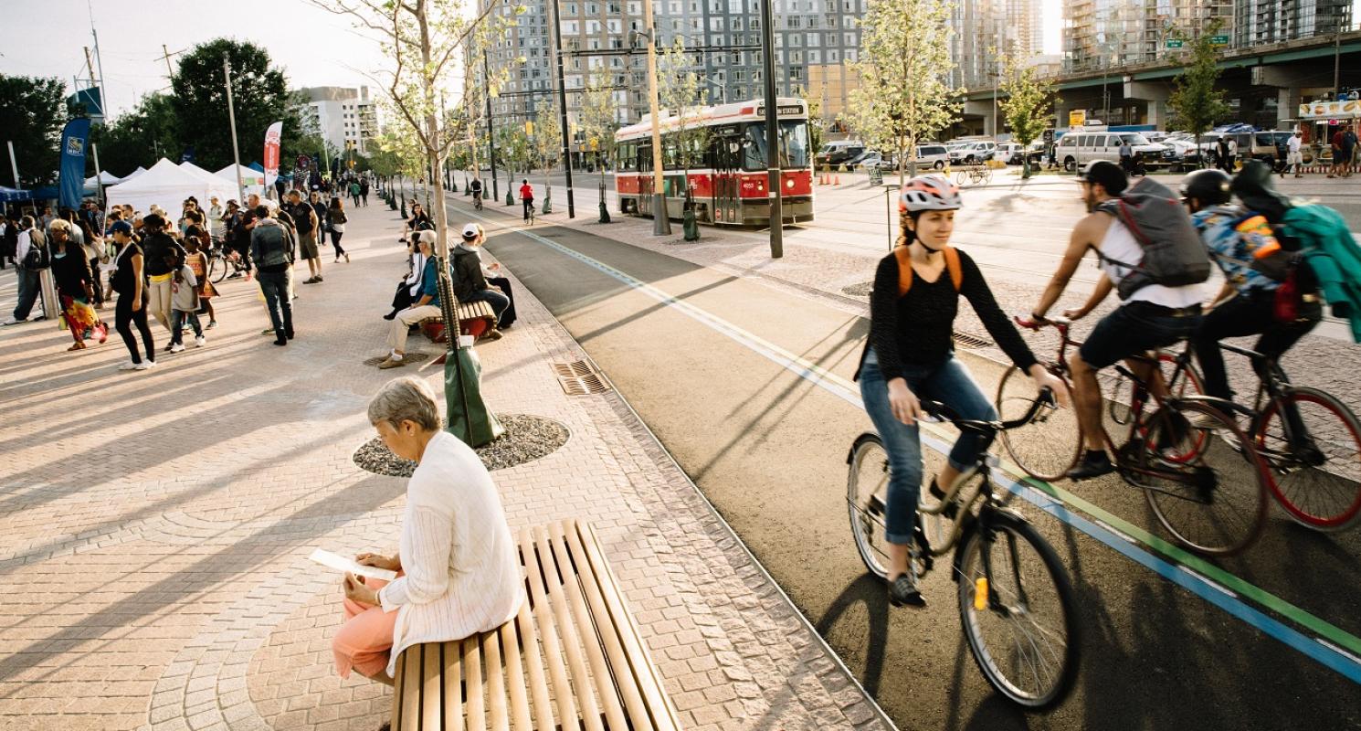
The plans for Queens Quay, which were developed after an international design competition and extensive environmental assessment process, ensure the area becomes a waterfront destination and not just the uninviting traffic corridor it has historically been. Queens Quay features two lanes of east-west traffic on the north side of the street with a dedicated Light Rail Transit (LRT) line in the middle.
On the south side, a generous granite pedestrian promenade defined by a double row of trees runs alongside the Martin Goodman Trail, a multi-use recreational trail.
Businesses and condominiums on the north side of the street now front onto widened granite sidewalks and a row of mature trees. Queens Quay provides the kind of atmosphere conducive to economic vitality, ground floor retail activity and urban vibrancy. It has become an iconic street that is as beautiful as it is functional.
This new world-class street links major destinations along the water’s edge, creates pedestrian and cycling-friendly promenades and encourages an economically vibrant area that serves as a destination for locals and visitors alike.
Quick Facts
Queens Quay Construction
Construction on this 1.7 kilometre stretch of Queens Quay in the Central Waterfront was completed in 2015. Queens Quay has been completely rebuilt both above and below ground. Waterfront Toronto led a coordinated construction effort that integrated improvements to the public realm with much needed infrastructure and utility upgrades.
Visit the Constructing Queens Quay page to learn how construction unfolded.
A Walk Through The Revitalized Queens Quay
After three years of one-way traffic on Queens Quay, the street was fully reopened to two-way traffic on June 10. Prior to reopening the street, we held a site walk where we stopped at key locations to explain how certain design elements help make this an efficient, safe – and beautiful – public space.
Read our blog post to learn more.
The Vision For Queens Quay
Waterfront Toronto has long recognized the importance of transforming Queens Quay into a world-class boulevard. Because Queens Quay runs the length of Toronto’s waterfront, giving this boulevard a new life is critical to Waterfront Toronto’s overall revitalization goals.
In 2006, Waterfront Toronto launched the Central Waterfront Innovative Design Competition. As part of its winning design, West 8 + DTAH proposed a design for Queens Quay that would make it a signature boulevard by reducing the number of lanes of traffic to allow for a generous new pedestrian promenade, cycling path and much improved landscaping in the area.
While Waterfront Toronto was an advocate of the winning design, it fully supported the statutorily-required Class Environmental Assessment (EA) process which had to occur before any work on Queens Quay could begin.
Linking The Gap In The Martin Goodman Trail
The Martin Goodman Trail, a 17 kilometre multi-use recreational trail, was disjointed as it passed through the centre of the city. Waterfront Toronto’s revitalization of Queens Quay connects the trail. Cyclists can now travel along a generous, four metre-wide, off-street Martin Goodman Trail from Lower Spadina Avenue all the way through East Bayfront to Parliament Street where the trail continues along Lake Shore Blvd.

