3 Ways Port Lands Flood Protection Supports Toronto's Ravine Strategy

The Don River is a major ecological corridor and an integral part of Toronto’s ravine system. Our work in the Port Lands means big changes where this 40-kilometre river meets Lake Ontario.
By Michela Comparey
At more than 300 kilometres and 11,000 hectares, Toronto’s network of ravines is one of the largest in the world. Port Lands Flood Protection is making part of this system healthier. We’re supporting Toronto’s Ravine Strategy by:
- Enhancing ecological function and resilience of ravines and watersheds
- Partnering to create more opportunities for individuals and organizations to contribute to our ravines
- Providing more opportunities for people to connect with nature and the city’s rich history
It all starts at the mouth of the Don River. What we now call the Port Lands was once the largest freshwater marsh in Ontario and the mouth of the Don River – the place where the river met the lake. When that marsh was filled in, that natual river mouth was lost and along with it, a critical piece of Toronto’s ravine system. Visit the Port Lands project website to read more about the history of the Port Lands.
Our design to protect 240 hectares of the city from flooding will also rehabilitate local ecosystems.
Why are ravines important?
The Don River is a critical part of an extensive ravine system. At more than 300 km and 11,000 hectares, Toronto’s network of ravines is one of the largest in the world. Ravines are incredibly beneficial to both the natural environment and the people who live near them.
- They provide habitat for wildlife
- They help cool the city
- They absorb and convey stormwater
- They provide recreational opportunities for people to experience nature in the heart of Canada’s biggest city
Toronto’s ravine strategy
The City of Toronto adopted the Ravine Strategy in 2017, and has since started implementing it. The strategy will “help to support a ravine system that is a natural, connected sanctuary essential for the health and well-being of the city, where use and enjoyment support protection, education and stewardship”.
The strategy has five guiding principles:
- Protect: to enhance ecological function and resilience of ravines and watersheds
- Invest: to achieve consistent and significant investments
- Partner: to create more opportunities for individuals and organizations to contribute to our ravines
- Connect: to provide more opportunities for people to connect with nature and the city’s rich history
- Celebrate: to encourage recognition of and respect for this beautiful and essential system
The work we are doing in the Port Lands supports these principles in several ways.
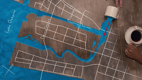
Right now, the Don River’s only outlet into Lake Ontario is the Keating Channel which is inhospitable to fish and other aquatic life. Right: The Port Lands Flood Protection Project will provide a more natural outlet for the river and improve the habitat for plants and animals that live along the Don. Visit our YouTube Channel to watch this video to learn more about how we’re protecting the Port Lands and surrounding areas from flooding.
1. Protecting the Don River and Surrounding Areas
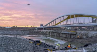
Flood protection is at the heart of this project. We’re creating a new mouth for the Don River so that in the event of a regulatory storm, excess water would be conveyed to the lake instead of overwhelming the Don Ravine and flooding the surrounding areas. This project will improve the resiliency of the Don River in the case of a large flood event while also protecting 240 hectares of the city from flooding. Instead of water inundating the ravine system and destroying nearby infrastructure, the new system will provide the resiliency to handle excessive stormwater and convey it safely to the lake.
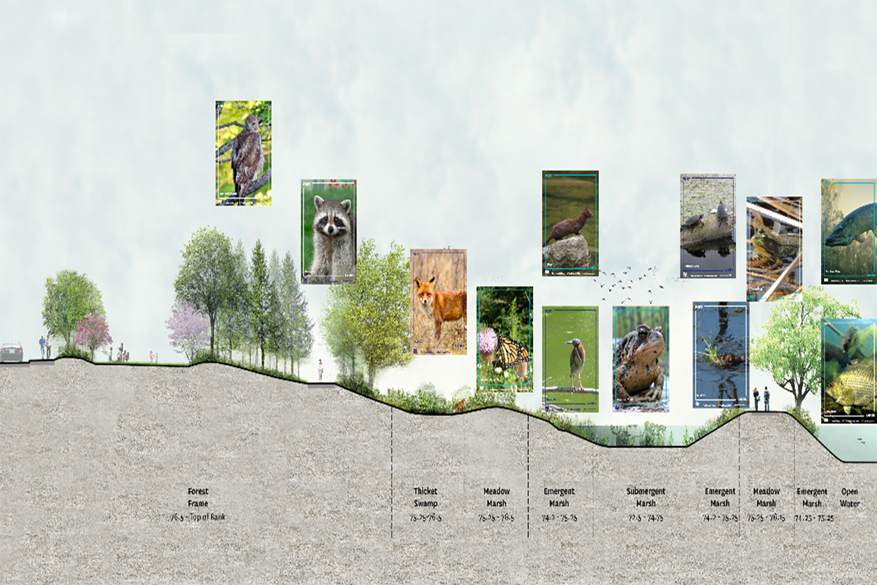
Cross section of the new Don River, showing fauna habitats it will create.
The renaturalization the mouth of the Don River will also improve habitat for wildlife and reduce obstacles for them to reach Lake Ontario. The 5,000 trees, 77,000 shrubs and over 2 million new herbaceous plants that we’re planting will provide shelter to migratory birds, fish, and all the other animals that call the Don River home. Visit the project website to download a species list of fauna habitats.
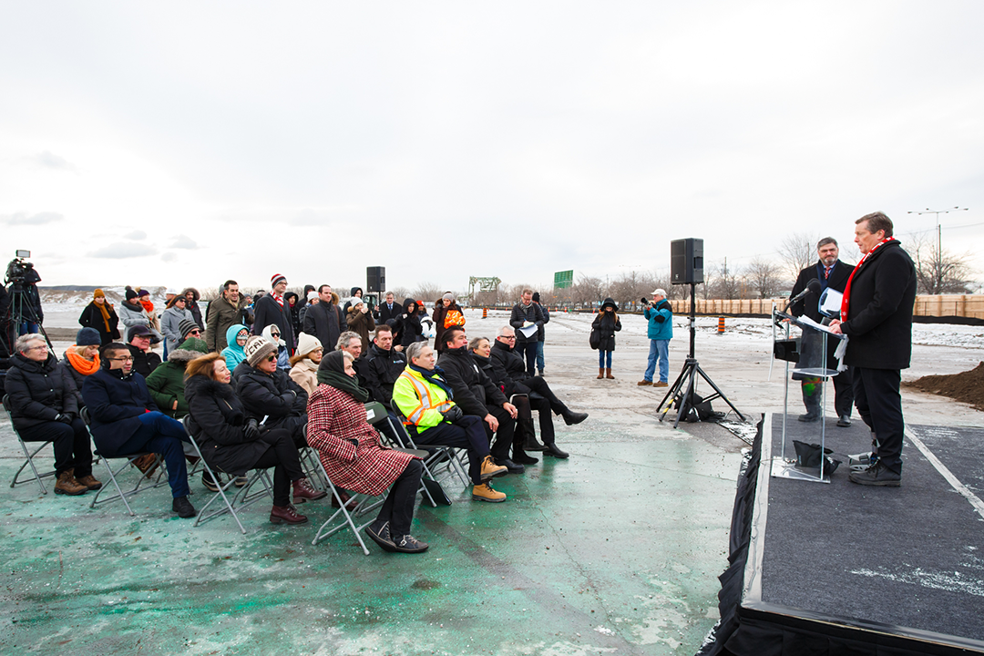
The Port Lands Flood Protection Project is supported by all three levels of Government. In 2018, Waterfront Toronto held a ground-breaking ceremony with government officials including Chief Stacey LaForme of the Mississaugas of Credit First Nation, Federal Minister of Infrastructure and Communities François-Phillippe Champagne, and Toronto Mayor John Tory (at lectern).
2. Investing Through Partnerships
This $1.25 billion dollar project was funded by the Government of Canada, Government of Ontario and City of Toronto, and is a strategic investment in the future of the city. The revitalization of the Port Lands and renaturalization of the mouth of the Don River is made possible through partnerships with the Toronto and Region Conservation Authority, Port Toronto and Create TO. Together, we have been able to consider many angles in the design of the Port Lands, from how the project will affect wildlife, to how it can contribute to sustainable growth in the city’s core.
3. Celebrating Our Connections with Nature
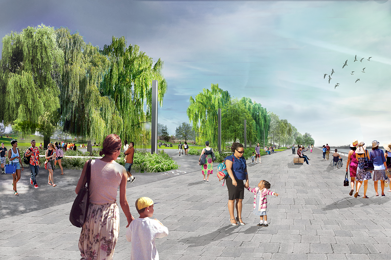
We’re building 25 hectares of publicly accessible greenspace where people can explore nature paths, go for a paddle, or have a picnic. Working with Indigenous Design Collective, MinoKamik, we’re celebrating traditional ways of relating to the water and nature, and also creating new ones.
Email us, tweet at us or join the conversation by following us on Facebook and Instagram.

Flood Protection Milestone Puts New Waterfront City Within Reach
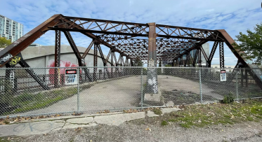
Why We’ll Soon Say Goodbye to the Old Eastern Avenue Bridge