Let the River Flow – Protecting and Revitalizing the Port Lands

A massive section of the lower east side and waterfront remains at risk of flooding from the Don River.
POSTED: JUNE 16, 2015
BY: CAROL WEBB
The Port Lands, at about 356 hectares (880 acres), is roughly the same size as downtown Toronto. An extensive, underutilized area on the eastern waterfront, the Port Lands presents an unprecedented opportunity for redevelopment.
Waterfront Toronto, working with the government and community partners, has developed a plan to transform this massive brownfield site to include new mixed-use communities with beautiful parks and natural habitats. But there’s a catch: the Port Lands are located at the foot of the Don River, which comes to an abrupt end and is forced to take a sharp turn when it reaches the harbour. Water doesn’t naturally flow this way and, as a result, the Port Lands and other areas nearby are at risk of flooding.
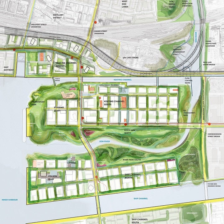
To make this vision for revitalization possible, we must first restore the mouth of the Don River to a more natural state and channel flood waters safely into Lake Ontario.
The new river mouth will be created by rerouting the existing river from its current location at the Keating Channel on the eastern side of Toronto’s inner harbour, to the middle of the Port Lands between the ship channel and the Keating Channel. The project will create a new river outlet to Lake Ontario, continuous riverfront open space and greater accessibility to the water. And it will protect the Port Lands and adjacent areas in Riverside and Leslieville from flooding.
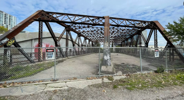
Doing this work will unlock the potential of the Port Lands as well as other nearby areas, including the former Unilever site. Similar results were achieved with the flood protection landform work completed in the West Don Lands, which provided flood protection not only for the West Don Lands but also a broad swath of the eastern downtown leading all the way to the financial district (see the area outlined in yellow in the photo above). This allowed for the revitalization of the central waterfront and East Bayfront precincts. This 30-second animation gives an idea of what the naturalized mouth of the Don River and nearby neighbourhoods might look like in a decade's time.
The flood protection and naturalization of the mouth of the Don River comes with a significant price tag, an estimated $975 million. It’s important to keep in mind that making this investment will help protect this area and mitigate a much more significant cost should a flood occur. And, it will unlock potential economic and cultural value by contributing to the revitalization and sustainability of the waterfront.
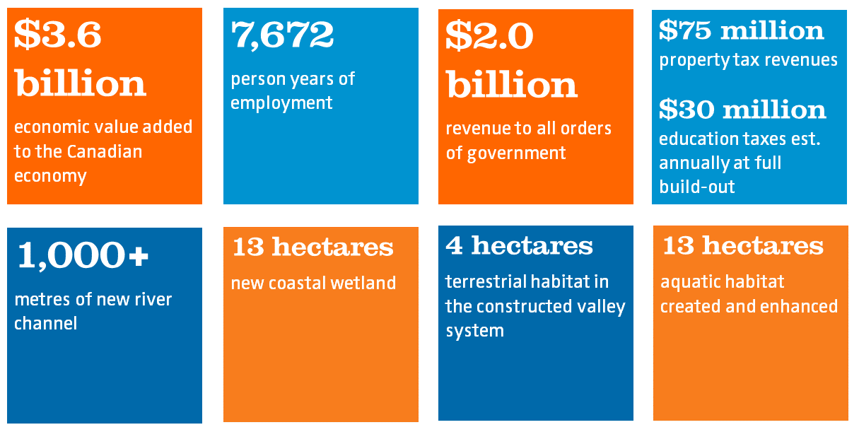
The projected benefit of revitalizing the Port Lands is massive, including billions of dollars added to the Canadian economy, thousands of jobs, new revenue for governments and significant ecological benefits.
Recently, the Board of Directors for Waterfront Toronto allocated $5 million to begin due diligence and initial project planning for flood protection work in this area. What does this mean? At one time this was the largest wetland in on the Great Lakes. Then, beginning in the 1880’s, infilling was gradually completed to make more land available for industry and shipping. We need to conduct extensive sampling across the area to establish a thorough understanding of the site characteristics, such as soil quality, capacity of the land to support new built forms, and the movement, distribution, and quality of water that flows through the site. The objective is to reduce the unknowns, identify risks and develop contingency plans.
Doing this work will provide critical information that will validate the estimated cost of the project, and will allow us to develop an implementation plan, procurement strategy and establish a workable schedule. The results will be delivered to all three orders of government by the fall of this year.
Naturalizing the mouth of the Don River and providing flood protection for the Port Lands was identified as a priority by the federal, provincial and city governments when they first established Waterfront Toronto in 2001. As part of the next 10 years of waterfront revitalization, the governments have reconfirmed flood protection as one of the four major priority projects. Once the project costs are validated, the next steps include securing funding commitments as well as negotiating implementation roles and responsibilities with a view to beginning work in 2017. From there, it will take approximately seven to ten years to complete the flood protection and related infrastructure work, including Promontory Park. It is anticipated that the first pieces of land in the Port Lands could be brought to the market for revitalization as early as 2021 or 2022.

Flood Protection Milestone Puts New Waterfront City Within Reach

Sustainable Skyline: How Mass Timber is Shaping Toronto’s waterfront