Myth: If you take down the eastern Gardiner Expressway, traffic will have nowhere to go.

The Reality: Many cities have removed their elevated expressways without replacing the road capacity. Defying common sense, the result has been a decrease in traffic and demand for roads.
POSTED: FEBRUARY 28, 2014 I ECONOMIC DEVELOPMENT, TRANSPORTATION, INFRASTRUCTURE, DESIGN
BY: CHRISTOPHER MCKINNON
Common sense would suggest that if you remove an expressway, that traffic must go somewhere, with the result being that the same number of cars will be trying to squish into fewer lanes, or clogging up other routes. However, what the evidence from real-life case studies shows is that a portion of the traffic simply “disappears.” While counterintuitive at first, the reality is that as commuters make decisions about how to travel into the city’s downtown, considerations such as traffic congestion, mass transit options, flexible work hours, telecommuting and technological changes encourage drivers to re-evaluate their option – which is a very rational thing to do.
The trends around the world show that the result of replacing elevated urban highways with at-grade boulevards has been a reduction in demand. What we see in cities from New York and San Francisco in the U.S. to Seoul in South Korea is that reducing or eliminating capacity actually results in reduced demand. Drivers weigh their options more carefully – some will continue to drive, some will take an alternate route, some will choose transit, some will walk or bike, and still some will choose not to make the trip at all. The net effect is a reduction in demand for roadway. This is best illustrated by the case of New York City’s West Side Highway.
A section of New York’s West Side Highway collapsed in 1973, prompting an immediate closure of a 6km segment. The traffic count dropped from 110,000 vehicles per day to just 51,000 vehicles per day using the surface route below the highway. About 12,000 vehicles were found to be diverting to parallel routes. The remaining 48,000 vehicles could not be found, suggesting that the trips were simply not made. To this day, traffic in that corridor remains 30% less than pre-collapse volumes, or the equivalent of 80,000 vehicles per day. See full analysis on page 32 of this report.]
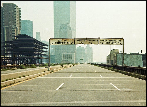
An image of the West Side Highway from 1979, six years after its partial collapse. (Image credits: Flickr user m.joedicke)
The Future of the Gardiner Expressway
In Toronto, we can already see this trend in action. The Gardiner Expressway has been operating at near-capacity since the 1970s, yet we have nearly 27,000 more people commuting into the downtown core for work each morning than we did in 1985. Virtually all of these new commuters are coming by TTC or GO Transit. There are 90,000 more people working in Toronto’s downtown today than there were in 1985. That means that employment has grown more than three times the rate of commuting. What can we conclude from these numbers? More Torontonians are choosing to commute by transit, walking and cycling. More and more Torontonians are choosing to live and work downtown, eliminating the need to make long commutes. These are important trends to understand, because between now and 2031 the number of people that commute downtown for work will grow by as much 200,000 during the morning rush. Virtually none of those new trips can be accommodated by our existing road system, other modes of transportation are essential to getting people to work, whether that is buses, trains, subways, bicycles or walking.
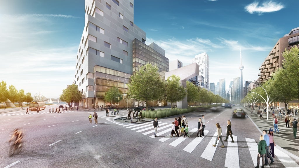
An architectural rendering that depicts how a ‘Grand Boulevard’ could replace the eastern portion of the Gardiner Expressway, opening up adjacent lands for mixed-use development and creating improved cycling and pedestrian infrastructure.
Forecasting the future demand of Toronto’s transportation network
The transportation modeling used in the Gardiner East Environmental Study forecasts future demand and modes of transportation based on today’s trends and our projections of how commuter behavior will change in response to how their city grows and develops. For example, we know that more people will be living downtown, with greater population densities and new downtown areas opened up for residential development. We also know that people who live downtown are more likely to walk to work. Similarly, we know that a portion of drivers will alter their behavior in response to changes in the Gardiner corridor. Some may leave later in the morning to avoid the busiest part of the morning rush. Others may choose to work from home or adjust their working hours. Some may decide not to take the trip downtown at all. In any case, drivers are making a rational choice based on their own self-interest and the value they put on their time. Enhanced options for public transit are important to meet the future demand for commuting downtown.
Given all of this, the 2031 transportation models created for the Gardiner East study should be regarded as highly-conservative, worst-case scenarios. Based on the traffic modeling, research and evidence from similar scenarios in other cities, we are likely to see impacts less dramatic than what our study predicts.
Even in the worst-case scenarios, removing the eastern portion of the Gardiner will mean a longer commute for a fraction of us. We have to be realistic: Maintaining an elevated expressway doesn’t solve Toronto’s congestion problem. Removing it will make congestion a little bit worse for some, but it will make a huge difference in the efforts to revitalize Toronto’s waterfront – it will earn significant new revenue for the city, allow for the development of new parks and public spaces, and, perhaps most importantly, help five waterfront neighbourhoods reach their full potential as dynamic places to live, work and play – giving us the space and the infrastructure we need to accommodate the City’s future growth.

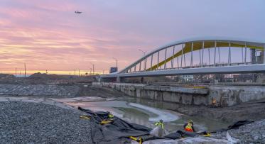
Flood Protection Milestone Puts New Waterfront City Within Reach
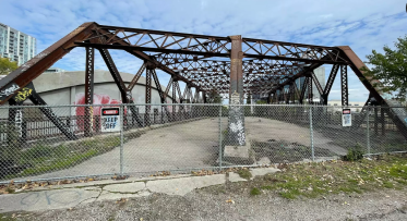
Why We’ll Soon Say Goodbye to the Old Eastern Avenue Bridge